Sometimes, it IS about the looks
A short while after I published my project here on Patreon, I also got permission to post about it in the X-Plane Subreddit. Generally, I have received positive comments and notions - thank you all for that!
One user pointed out that crop fields don't look quite as good - they only have their resource, which ends somewhere. However, in reality, many of these fields have a bush or scrub along their edge. Indeed, I live in a smaller city which has some large farmlands around it. Oftentimes I walk by one of those with my dogs, and in fact - it has a bit of grass and bushes as an edge. I looked at others in my immediate area, and he is right.
To battle some appearance issues with many of these crop fields, I introduced a mechanism that would draw massive, random lines, in random degrees, which would serve as a mask to overlay another material on them. While it technically worked, in some parts they looked like massive stripes that could make you think there is a bug or other problem with the texture, and it didn't really look as good as I wanted.
So I changed that and implemented a sort of bush or scrub thing along the edges. Also, the big "lines" are no more. Instead, they are very thin and decent alpha-blended lines now, serving more like an optical divider. Indeed, this does look better.
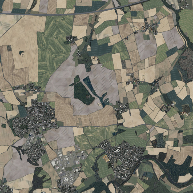
In this new render of a part from the demo tile, we can see this new mechanism quite prominently. Not only do the farmlands have a subtle optical divider in them, they are also more distinct in outlining their area.
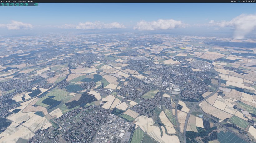
Bringing the new tile into the simulator, we can also see the dramatic effect this now has on the display of such areas. It provides a much more tangible and realistic feel.
So thanks swoohoo79 for the suggestion!
In addition, I have reworked many parts of the texture pool for zoom level 16.
Up next: mountains.
I completed the rendering of the lat-long tile +47+011, which is the tile with the Innsbruck (LOWI) airport. I relied a bit too much on OSM data, meaning I also relied on the data being built with their elevation in mind. But truth be told: it is not. Not always anyways.
What happened?
Let me put it this way: it is very unlikely you'll find stretched farmlands at these peaks. And it looked... surreal. Like a Dali painting.
So it was clear that this needed to be solved. What I discovered is that the tag natural:bare_rock is more symbolic than anything else - it tells you where rock is, but the mechanism I used does not fare too well in the vertical.
Instead of using pre-rendered backgrounds to fill in the blanks, which was the case before, this has been replaced with a mechanism that reads the elevation model for the tile, and renders a blended background depending on height levels.
Again, I hand-curated materials for this use-case - material that is not in the texture pool to make it stand out.
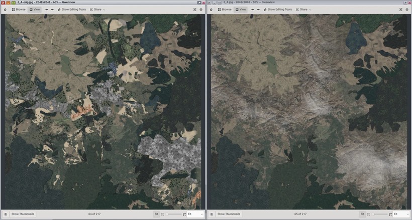
On the left you can see the previous render of a mountain range near the LOWI aiport, and on the right the result with the improved mechanism. I'm not a graphic or game designer at all, but I would say the result on the right is much more desirable for mountain ranges.
These changes are now in the build of Orthographic, and I will immediately start to render out the existing tiles with the new imagery.
Now on to the next leap forward in next-gen ground imagery synthetization!